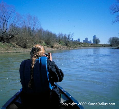
 The
Main Stem of the Trinity River begins at the confluence of the Elm Fork
and the West Fork, in the Dallas Floodway, and flows east and south past
downtown Dallas into the Great Trinity forest. The Main Stem runs between
very steep banks of floodplain soils and occasional shale and limestone
outcrops, and is bordered by floodplain trees, grasslands and wetlands in
the Dallas Floodway and extensive bottomland hardwood forests in the Great
Trinity Forest. Bird watching is excellent, and wildlife sightings include
coyotes, snapping
turtles, alligator gar and beaver. A number of creeks and drainage ways
flow into the Trinity Main Stem, especially at higher river levels. There
are trips from 5 to 10 miles in length on 23 miles of the Main Stem, which
has a dependable flow all year. One small rapid is located beneath the
Inwood-Westmoreland bridge. There are a number of navigation lock and dam
structures downstream of South Loop 12 on the Main Stem, beginning with
Lock and Dam #1 at McCommas Bluff. The lock area on river left is often
blocked by logs or flood debris, but might be navigable at higher river
levels. The dam ruins on river right have been run, with caution, straight
over the drop. Lock and Dam #2 is upstream of Belt Line Road; it requires
scouting and usually must be portaged. Below Malloy Bridge there are more
structures, starting with a dam near the mouth of Ten Mile Creek, which
must be portaged.
The
Main Stem of the Trinity River begins at the confluence of the Elm Fork
and the West Fork, in the Dallas Floodway, and flows east and south past
downtown Dallas into the Great Trinity forest. The Main Stem runs between
very steep banks of floodplain soils and occasional shale and limestone
outcrops, and is bordered by floodplain trees, grasslands and wetlands in
the Dallas Floodway and extensive bottomland hardwood forests in the Great
Trinity Forest. Bird watching is excellent, and wildlife sightings include
coyotes, snapping
turtles, alligator gar and beaver. A number of creeks and drainage ways
flow into the Trinity Main Stem, especially at higher river levels. There
are trips from 5 to 10 miles in length on 23 miles of the Main Stem, which
has a dependable flow all year. One small rapid is located beneath the
Inwood-Westmoreland bridge. There are a number of navigation lock and dam
structures downstream of South Loop 12 on the Main Stem, beginning with
Lock and Dam #1 at McCommas Bluff. The lock area on river left is often
blocked by logs or flood debris, but might be navigable at higher river
levels. The dam ruins on river right have been run, with caution, straight
over the drop. Lock and Dam #2 is upstream of Belt Line Road; it requires
scouting and usually must be portaged. Below Malloy Bridge there are more
structures, starting with a dam near the mouth of Ten Mile Creek, which
must be portaged.
